Monday, 21 October 2013

Once we reached Port Augusta we certainly had a change of scenery, and weather.   It got cool while we were still in Port Augusta but then as we left and came up through the Clare Valley it got colder.  It was down to 2 degrees the first morning we were there.  Heater time - but two days later we had the air conditioner on again.
 
This is on the way down from Port Augusta to Port Pirie - it was very pretty.  Paddocks of wheat or barley either ready to be harvested or very close to it.  Some going almost down to the water's edge of the Spencer Gulf.
 

The Jetty at Port Germain.  One of the longest wooden bridges in the southern hemisphere at 1,550 metres long.
 
Port Pirie. 
 
Even though Port Pirie is an industrial city they have lots of parks and gardens and a really nice area along the foreshore.  They also have nice gardens down the main street with lots of roses.  Roses seem to grow really well in all these areas down here.

 
Some art work in Port Pirie - they must have known cold weather was on the way!

 
The Smelter at Port Pirie

 
Wheat Silos at Port Pirie.

 
Southern Flinders Ranges. 
 
It was so green once we crossed the Southern Flinders Ranges the wheat and barley had not yet ripened and it was so green.  Everywhere as far as you could see was green.  It certainly was a nice change.

 
Enjoying an ice cream, locally made, at Laura in the Southern Flinders Ranges.  Very yummy!

 
From a lookout looking back towards Spencer Gulf.

 
A statue of CJ Dennis who lived in Laura for part of his childhood erected in the main street of Laura


Along the wharf area of Port Augusta.

 
The main street of Port Augusta.
 
After leaving Port Augusta we went up into the Clare Valley where we stayed for two nights at Clare.  It is a very pretty area - all wheat and barley paddocks or vineyards.  All the grape vines were starting to shoot and it was very green in every direction.  We were talking to one of the  small winemakers who said that their season maybe wrecked as the grapes were shooting too early and the morning the temperature dropped to 2 degrees they had some big frosts in parts of the valley which will have destroyed the buds on the vines.  They normally get temperatures equal to our winter temperatures up until about the end of October so the warm weather came about three to four weeks early but then it got cold again, but has warmed up again now.
 
 
Crystal Brook. 
 
 Another little town we passed  through that had some old stone buildings, and a very nice little bakery. 


St Aloyuis Church at Sevenhill Winery just outside Clare. 
 
 
 Sevenhill Winery was started in 1851 by the Jesuit Priests and is still run by them.  It is a very peaceful and scenic place.  As well as the church and winery they have another beautiful stone building where they have meetings and retreats.
 
 
These very fat cattle were in a paddock opposite the Sevenhill Winery. 


Mintaro.
 
A heritage listed town near Clare.  It did have some nice old buildings and pub but it looked a bit run down.
 
Just outside Mintaro is Martindale Hall.  It was used in the movie 'Picnic at Hanging Rock' as the boarding school.
 

Martindale Hall.
 
You can go through it but it is also let out as an upmarket B&B and you cannot go through those rooms.  We didn't bother going into it.

 
Some of the countryside around Clare.

 
A winery we went to.  It was just down the road from the caravan park where we were staying and was run by a very down-to-earth, friendly bloke.  He had some very nice wines too.

 
Vineyards around Clare.

 
A tribute to 'Curio' a famous buckjumper at Marrabel.
 
Curio was a brumby captured when she was about 3 years old and it was about eight years before she was ridden for 10 seconds.


The main street of Marrabel - not a very big town but they obviously have some community spirit.  They had a lovely area with barbecues and shelters which all had murals on them depicting the pioneering era of the area.  These murals were all done in black on white titles.  They also had two tennis courts which looked like they were being used for junior tournaments the morning we passed through.

 
Another wheat paddock.

 
A park in Eundunda where they had a statue of Colin Thiele.

Colin Thiele.
 
One of his books was "Pelican Boy".  In 1993 he retired to Dayboro where he passed away in 2006.
They were lovely gardens where they also had a lot of murals made out of the black and white tiles and also a lot of lavender which was flowering.


The ferry across the Murray at Morgan.
 
I couldn't believe all the house boats on the Murray at Morgan.  Looking along the river from the ferry crossing the banks of the river were just lined with house boats.
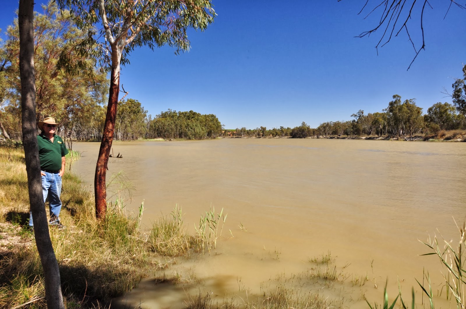
 
Camping beside the Murray River at Herron Bend.
 
It was a free camp right on the banks of the river.  I thought it would be crowded but in the area where we were there were two other caravanners and a house boat. Down the other end of the area there was one house boat and it looked liked two campers. 

 
Looking back down on the free camp area.
 
Since leaving the Clare Valley the countryside has been quite dry in areas but in other areas closer to the river there have been vineyards and citrus orchards which have been really green.

Lock Number 3 on the Murray River.
 
This was just up the road from where we had camped.

 
A group of canoeists came through while we were there so it was interesting to see how the lock worked.

 
We happen to pass through Renmark during their Rose Festival.  Just outside Renmark is Rushtons Roses - they had acres and acres of roses - all in bloom.

 
They obviously had a scarecrow competition as part of their festival as all these scary crows were lined up in the park in the main town area.  I liked Renmark - it was a very pretty town and had lots of roses and big trees (mostly jacarandas) down the main streets.  They also had a nice picnic area along the river bank but that seems to be the done thing for all the towns along the Murray.

 
More roses in Renmark.

 
Leaving South Australia and entering Victoria.  Actually I was a bit confused if this was the actual border or the fruit fly check point.  The arch over the road did say you were leaving South Australia and entering Victoria but about four or five kilometres further down the road were small, insignificant signs saying farewell to South Australia and Welcome to Victoria.

 
We are presently in Mildura staying at the Apex Riverbeach Caravan Park which is right on the Murray River.  This Paddle steamer went past the caravan park this afternoon.

 
There is a weir on the Murray here with another lock so we went down to see the Paddle Steamer going through the lock.

 
Mildura. 
 
Mildura is quite a bit town (city) with all the usual shops and shopping centres.  It seems quite nice but not a lot to see or do.  They have a huge aquatic centre with indoor and outdoor pools and a wave pool which is at the same place as the information centre.  It was very popular when we arrived yesterday afternoon when the temperature was about 35. They also must play a lot of tennis here as they have a large grass tennis court complex.


These sculptures are in a park here in Mildura - don't ask me what they represent - I couldn't quite figure them out.  
 
We leave here tomorrow and will be making our way over to Echua having a look at the towns along the way. We will probably have two or three days in Ecuha before moving on.

Sunday, 13 October 2013

Here we are at our first night's camp in South Australia at Agnes Creek enjoying a bottle of champagne Gwen received for her birthday.  Only problem was the flies were so thick we had to wear our fly nets or be driven insane and it was a little difficult to drink through the net.


The next morning we stopped at Marla which consists of not much besides the roadhouse which is a petrol station, convenience store, pub and caravan park all together.  Marla did have this lovely green park over the road from the roadhouse and the galahs were having so much fun in the sprinkler.  When the sprinkler hit them they would put their wings out and dance around, trying to stand on their heads and rolling all around the grass.


They were making real galahs of themselves but were so funny to watch.
 
It was then onto the moonscape of Coober Pedy.


Coober Pedy was quite different to what I was expecting.  It seems the opal mining is much more commercialised here then in Lightning Ridge.  The mullock heaps were much larger and more of them (they stretched for miles in every direction) then I was expecting.
 
Over looking Cooby Pedy.
 
 
Another skyline scene.  Note the water tanks and TV aerials - they are on top of people's homes (dugouts).
 
Inside the catholic church which is underground. 
 
Most of the buildings are underground although they are different to what I was expecting an underground dwelling to be.  As they are built into the sides of hills and have air vents down to them to let in light and air it doesn't really seem like you are underground.
 
 
As with these types of mining towns, they have a quirky sense of humour.  This is the sign to their cemetery.  One of the graves had a beer keg as a head stone and instead of flowers had empty beer and wine bottles.


These contraptions are called 'blowers' and they are like giant vacuum cleaners.  They are used to suck all the rock and dirt up out of the mine shafts.  Every mine has one.
 
 
I wouldn't mind picking up one of these rocks!  I am not sure if you can read the sign.  It was found in 1983 and is called the 'Painted Lady'; weighs 80 to 100 kilos and is valued at $30,000.
 
 
This is on the way out to the Breakaways. 

 
The Dog Fence which stretches all the way to Qld. 

 
The Moon Plain - also on the way out to the Breakaways.
 
 I can understand why they chose to make Mad Max Beyond Thunderdome out here.  They have made quite a few movies in this area - Priscilla Queen of the Desert was another one made around here.
 
 
The Breakaways


We went out to watch the sunset from the Breakaways but it wasn't terribly good and the flies again nearly drove us mad.
 
 
Anyone for some salt?


Walking on Lake Hart - a salt lake .
 
 
Lake Hart

 
We saw some of the cars taking part in the Darwin to Adelaide Solar Power Challenge.  The day we left Cooby Pedy is was very hot (reached about 45 degrees) and gale force winds.  This little bloke was getting blown about quite a bit.


I am not sure I would like to be in one of these passing a road train.


Another salt lake - Lake Gardiner  - the third largest salt lake in SA, apparently.


We were staying at free camps between Cooby Pedy and Port Augusta and the one we had chosen for this night was a lookout.  As we had gale force winds blowing all day we thought we might go onto Pimba as the free camp there was at the Roadhouse and we thought it may offer some shelter from the wind.  As you can see we were sorely disappointed.
 
 
These photos don't really show it but the dust blowing was unbelievable.  It reminded me of those movies you see when everything is dry and dust blown and there is no civilisation in sight.
 
 
The morning we were leaving Pimba.
 
As Pimba was only 9 kilometres down the road from Woomera we decided to go into Woomera to have a look.


All these rockets and planes were on display in the town.
 
 
It was quite surreal driving around the town.  There are a number of houses, a lot of unit blocks (two storey), large school, swimming pools, parks and paths and appears that there are only one or two people living in each unit block and only a few of the houses had signs of occupancy.  Back in the 60's and 70's there were approximately 4,500 to 5,500 people living here and back then it was a 'closed' town i.e. only military personnel were allowed in.  Now it is open to the public and we were told only about 180 people live there.  It is still owned and operated by the Commonwealth of Australia and anyone living there must work there.


Another salt lake - Island Lagoon.  Apparently it was on the edge of this lake where they launched the rockets into space.  That area is still closed to the public.
 
 
The view from the front of the Caravan Park we are staying at in Port Augusta.  That is a train from across Spencer Gulf with the southern Flinders Ranges in the back ground. 
 
There is a large number of trains which go through Port Augusta.  All the trains coming down from the mines up north and all the trains going to and from Perth and Darwin all past through Port Augusta.
 
 
Another view from the front of the Caravan Park.  This is looking up towards the end of the Spencer Gulf.


Taken from the jetty looking south into Spencer Gulf.
 
 
'The Barge'


Looking across Spencer Gulf to the southern Flinders Ranges.  The mountains may look painted but this is a real photo.
 
There is a road going south of Port Augusta along the shoreline of Spencer Gulf called Shack Road.  Down this road there are what they call 'streets' running towards the water and along the water's edge are built what is called 'fisherman's shacks'.  I wouldn't mind owning one of these 'fisherman's shacks' but I don't think my budget would stretch that far unless I win one of the Lotto jackpots.
 
At the turn-off into the 'streets' going down to the 'fisherman's shacks' are these signs.  Apparently they have all named their 'shack'.  Some of them are very imaginative like 'Footrot Flats'; 'Chubby's Cubby' and others have very fancy signs.


As you can see in the background the 'streets' are only dirt tracks.  Quite an interesting little area.


The Port Augusta power station - apparently it provides 40% of SA's electricity.
 
 
Today we went down to Whyalla for the day.  This is the lighthouse at Point Lowly.
 
Again today it was very windy, and cold, and there were a lot of squally showers around.  Quite a change from last week.


The HMAS Whyalla - the first ship built by the Whyalla shipyards and was commissioned in 1942.  It was a mine sweeper in World War II.
 
 
The Mess where the sailors ate, slept and socialised.  It was built to house about 70 sailors but usually had over 100.  I think it would have been crowed with 30 or 40 people in it.


A view of Whyalla from Hummock Hill Lookout.
 
 
A monument to Matthew Flinders and Claude Freyicnet both of whom explored and named a lot of the area around Spencer Gulf. 
 
I did not realise Spencer Gulf was so large.  Whyalla is not even one third of the way down the gulf and you cannot see the other side.


We found this fellow outside a Vet Clinic. It is a monument to 'The Loaded Dog'.  Anyone who is familiar with Henry Lawson's work will know the story of the Loaded Dog.


Iron Knob - Iron ore mine.  The township looks very neglected and derelict so I am not sure how much mining is still happening out there. 


Another little local who was lucky to survive crossing the road.  It is a shingle back lizard.  There are quite a lot around here.
 
We will probably stay in Port Augusta until next Thursday.  We are going down to Port Pirie to have a look around the eastern side of the Spencer Gulf tomorrow.  We are having the car serviced on Tuesday - we have driven a lot of kilometres since leaving home.  I suppose then we will have to start heading back towards home.