
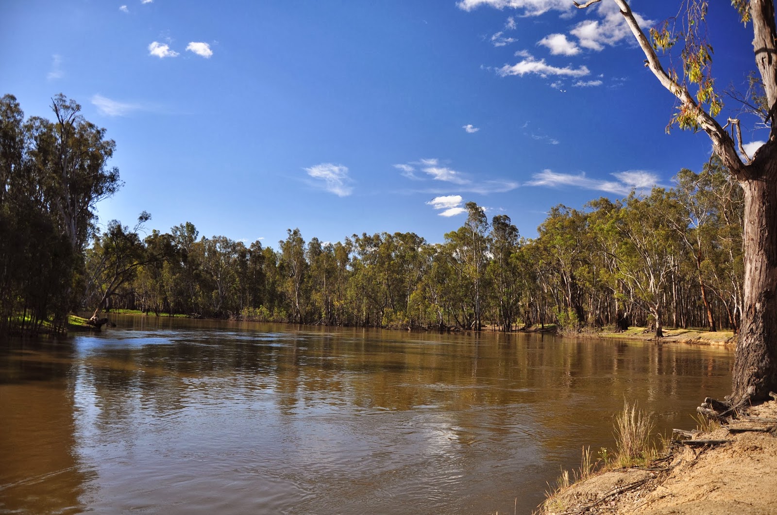
This is the Murray River at Nyal Vic. We had a free camp here at the Nyal Recreation Reserve which is their Showgrounds. It is also their football field and cricket pitch. It was a big area and there were quite a few other travellers staying there as well. We had some rain the night we were there and also quite a lot of wind. It was then on to Swan Hill where ......

....they had a little trouble telling the time. The correct time was 10a.m.

We found this pair grazing at the Information Centre at Cohuna. It was so lush and green there.

Kow Swamp not far out of Echua. There were lots of lakes, some quite large, on the way across to Echua.

The Murray River at Echua at the Historic Precinct. They are currently rebuilding the wharf and walk ways at the Historic Precinct as well as a new interpretive centre and re-constructing a sawmill. It should all be finished this December.

The re-built wharf. It has been re-built using the plans for the original wharf although the original wharf was much longer.

The 'Pevensey' an authentic paddle steamer which we went on for a two hour cruise up the river.

We then went on the 'Pride of the Murray' for a dinner cruise. Both were very good.

Some of the roses growing around Echua. All the towns down here have the most beautiful roses growing in their streets and public gardens. As well, some of the residents have gardens dominated by roses which are all in bloom at the moment.
The main street of Echua.

These units were at the caravan park where we stayed. It was a different type of caravan park! They only had about five or six powered caravan sites which were situated around their barbecue area - no designated sites (there was only one other caravan there besides us) - a small area for unpowered camping and the rest of the site, about 30 odd acres, was all units/cabins. Most are privately owned as holiday places but these ones are for rent. There are two rows of them, one row overlooking the river, and they are designed to look like an old west town.

The Murray River - at sunset.

These were taken on our dinner cruise.

We also visited the Holden Museum. A bit scary - I can remember when quite a few of the cars there were on the road (not these ones).

We also had to visit the Beer Shed. He has numerous beer cans, including one of the oldest in the world, from all over the world as well as a lot of those museum items such as old petrol bowsers. Too much to take in, in one visit.

We went for a drive around the area and one of the places we visited was Rochester where Hubert Opperman came from. His achievements were: Won the Australian Road Cycling Championships in 1924, 1926, 1927 and 1929, won the Bol D'Or in Paris in 1928, was highly placed in the Tour de France the same year and won the 1,265 kilometre Paris-Brest-Paris race in 1931. In that year he was also voted 'Sportsman of the Year' by a French Newspaper. He later became a Politian. His first job - a telegram delivery boy!!!

Another place we drove through. It is very picturesque countryside.

From Echua we travelled all the way out to Barmah - all 30 kilometres but I wanted to see the Barmah forests and it was on our way to the next leg of our journey.
At the moment they are releasing enough water into the Murray River to create a controlled flood in the Barmah Forest area. There are lakes in the same area, as well as an area they call the 'Narrows' or 'Choke' being where the Murray River is very narrow. It is an internationally environmental sensitive area. This area needs a flood at least once every three years to ensure that the Murray River Red gums survive and grow, as well as a specific grass that grows in this area. The rushes growing along the edge of the lakes and in the shallow water also become a pest if there is not a regular flood - the flood actually kills the rushes.
The photo above is of the picnic area at the Barmah Forests.

The graziers of this area were allowed to let their cattle graze in the Barmah Forests area and once a year they were mustered and brought to these old yards where they were drafted and returned to their rightful owners. Now that it has been declared a National Park this practice has been stopped much to the disgust of the locals. They still use the yards once a year for a week-end where they hold a 'show' reminiscent of the annual cattle muster.

We went on a boat cruise at Barmah Forests, which normally leaves from the picnic area but as that was under flood we boarded the boat at Broken Creek. The photos above and below are of Murray River Red gums along Broken Creek.


Crossing Lake Moira. It was a very still, cloudy day and the reflections were awesome.

Some more of the Barmah Forests.
Another view of the Murray River - this time from the caravan park at Barmah where we stayed.

A forest of Murray River Red Gums.

Leaving Barmah we travelled north along part of the route they call 'the long paddock'. Along this route they have historical signs and most of the little towns have some sort of sculpture depicting the early life of that area. This one is at Mathoura and is in recognition of the Drover.

We travelled the long paddock to Deniliquin which is pretty town. These statues, and church, are in a lovely park which runs parallel to the main street. There is a story to the statues - they are made of marble and were imported from Italy. Apparently during World War II some important statues went missing from Italy and it is rumoured that someone investigated if these may have been those statues.(????)

This is a climbing rose growing on a trunk of an old river red gum in the park.

The War Memorial at the corner of the park.

Some of the roses growing at their Visitors Information Centre. I also liked their very wide footpaths in the centre of town

This ute has been decorated in Mosaic - the design depicts so may things, most of which I could not find. There is apparently wheat fields, setting sun, hay bales, the milky way ............ a bit much for my imagination.

And of course the ute on a pole.

Another camp on the Murray River just outside Barooga. This is taken from the front step of the caravan. Not a bad view.

Look what I found!! Or rather what found me. He was beautiful but I wasn't allowed to put him in the back of the truck to bring home with me.

Lake Mulwala. A bigger version of Kow Swamp. It is bordered on one side by Mulwala (NSW) and you cross the Murray to the other side to Yarrawonga (Vic). They are both very much holiday towns with lots of units and motels. They have obviously cleaned all the dead trees out of the end of the lake near the towns as they have quite a big ski club there.

Some sculptured brolgas at Corowa.

The town clock at Corowa - at least they get the time correct on each side of the clock.

Albury Railway Station and this one is still in use - as a railway station.

Memorial Hill. This is their war memorial and is on top of the highest hill at Albury. You can see the memorial from just about anywhere in Albury. If you stand in front of the memorial you can look straight down the main street of Albury and at the end of the main street and next to the Railway Station is a bridge over the railway line that has a big arch built over it which is also lined up with the monument.

The Murray River at Albury.

They have these beautiful parklands along the river at Albury - beautiful big trees. It is a lovely area to go for a walk or a picnic or barbecue especially on a hot day (which it wasn't when we were there).


These two photos above are of the Hume Dam which was first completed in 1936. When it was first built it was the largest dam in the southern hemisphere and could hold 1,522 gigalitres. The building of it was quite astonishing really - it was built using horses, steam engines and manual labour which included the hand-to-hand passing of rocks. I bet you couldn't get anyone to do that sort of work now. Nine lives were lost during the construction which, when you consider the work conditions was probably pretty good. It was heightened in 1950 to 1961 which increased it's capacity to 3,038 gigalitres and a hydro-electric power station was added in 1957.

Just past the Hume Dam is a little place called Bonegilla. It was initially built as a military base but after the Second World War it was converted to a migrant centre. Many migrants coming to Australia as 'displaced' persons came by ship to Melbourne where they were put straight onto trains which brought them up to a railway siding near Bonegilla from where they were then loaded onto buses and brought to this camp which at that time was in the middle of nowhere. It must have been a shock to them. They stayed here until jobs could be found for them. The huts are very primitive and when it was first opened as a migrant centre the men were separated from the women and children. The buildings were at first just one big room but later they were divided into little units and married couples were allowed to stay together. But the rooms were big enough to put in two single beds and a little cupboard and not much more. Reading the reports most of the migrants weren't very happy here and it appears they had the same problems as they have now in the migrant centres. This area is being restored as a museum but the larger part of the area which is on the other side of the road is still used as a military camp.

Scenery along the Hume Dam. It is so green down here that most of the countryside looks like parkland.

We are now entering the Man from Snowy River country. Corryong.

Another sculpture of the Man from Snowy River - this time outside the Visitors Information Centre in Corryong.

Looking toward the Snowy Mountains from the Southern Cloud Memorial Lookout. The Southern Cloud was a plane that was flying from Sydney to Melbourne and crashed into the mountains killing the pilot, co-pilot and all six passengers. It was in the early days of commercial flights and back then they had to rely on weather reports which were probably 24 hours old and the planes did not have any radios - sounds rather primitive now. The plane wreck lay undiscovered for many years and was found by accident by a worker on the Snowy Mountains Scheme who went bushwalking to take photos of the mountains and accidentally stepped on parts of the plane.

Looking towards Mt Kosciuszko - that is it right in the back of the photo. It doesn't look to have much snow on it. They did actually have a big snowfall about a week ago but it has probably all melted by now.

Another free camp - this time on Paddy's River near Tumbarumba. It is a very pretty spot and there were quite a few caravans, motor homes and camper trailers there but very cold. Thank goodness we have a gas heater.

Paddy's River waterfall.
We arrived in Tumut this afternoon. We are spending a few days here - need to catch up on some grocery shopping and washing. We will also go for a couple of drives up into the Snowy Mountains and hopefully see some snow. I am a bit doubtful that we will see much snow as it has warmed up quite a bit over the last couple of days. The nights are still getting down to about 6 or 7 degrees but the days are getting up to the mid 20's. Certainly better then the heat we had coming down through the centre.